I love using maps in the history classroom.
I often joke about geography being all about colouring in maps, but in reality, I’m jealous.
It might just be me, but I need to locate myself in time. The chronology of most things is an obsession. It might be the date of a song, of a TV show, or any event in history.
‘What year was that then?’ I always seem to ask myself.
But it isn’t just time, I also need to know where I am geographically. I need to know how far away things are. And, its important to know where places are in relation to one another.
Basically, I love maps and think they are a great tool to use in the history classroom. Just don’t tell the geographers.
Maps help pupils to locate themselves locally. They help them to understand where they are in the world. And they help them to see places that they haven’t previously heard of.
But maps are so much more than that. Maps can be used as an historical source.
They can be used to show complexity, to challenge lazy misconceptions and even be used as historical data.
So here are 5 ideas to help you to use maps to enhance the learning of history in your classroom.
1. Locating the event you are studying geographically
I know it seems super obvious, but it’s really helpful to show your pupils where the event is that you are studying on a map. AND, then showing them how far your school is from the event.
You can do this for UK based events AND events across the globe.
I realised this was hugely important a few years ago. As an experiment I asked some pupils to come up and point out where certain Cold War hotspots were.
Few had a clue where Korea was, or Vietnam. And, since then, I have felt its important to help them increase their generally geographical knowledge.
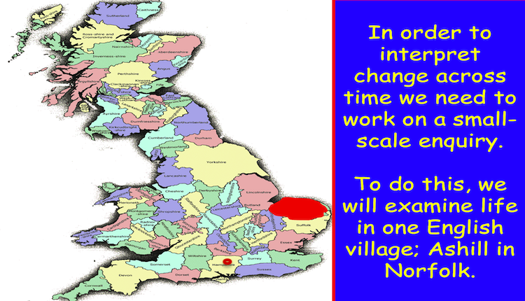
You can do this in a single slide. As Neil Bates did in a lovely enquiry into enclosure in Norfolk.
Or if you are studying the Cold War you could spend a whole lesson on this.
2. Using Maps in the History Classroom to Show Movement in the Past
Individuals in the past have undertaken some pretty impressive journeys.
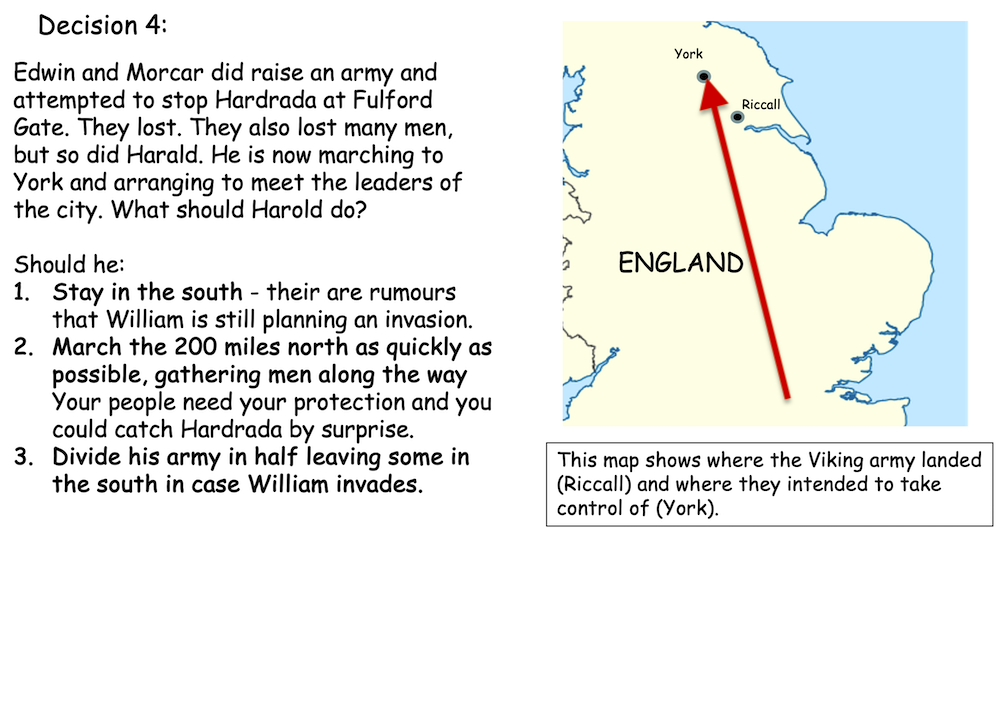
So, its important that we can show these visually. Most English teachers focus on the fateful year of 1066.
Showing Harold’s impressive march north – and back – is a clever thing to do. This map comes from our free 1066 decision maker lesson.
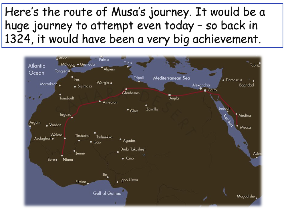
You can show the unbelievable journeys of people like Mansa Musa for example.
You can also do this at GCSE. Those of you teaching the Elizabethans, or migration, may look at the amazing journey of Sir Francis Drake.
Why not get your pupils to really engage with this journey by getting them to plot it using cards?
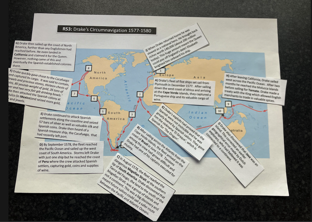
Then, get them to do more analysis of the journey by asking pairs to classify the narrative to help the begin to consider Drake’s significance. And, compare him with Raleigh, to decide whose portrait should stay in the National Portrait Gallery.
3. Using Maps in the History Classroom to Challenge Misconceptions
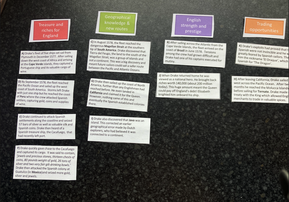
It’s a great idea to actually get your pupils to annotate maps in the history classroom. This can help them to challenge misconceptions. When teaching African history, Elena Stevens suggests we should challenge Hugh Trevor Ropers 1960s view. He said there was no movement in Africa until Europeans came.
Elena gets gives pupils information about African movement and gets pupils to process this by classifying it.
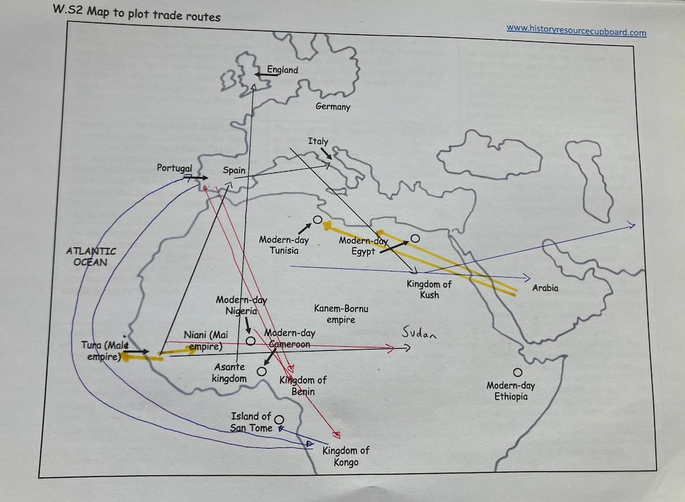
Then pupils plot this movement on a map to show what goods were transported in and beyond Africa. As you can see above
Finally, they discuss how Trevor Roper wasn’t simply racist, but was a product of the time he wrote in.
You can download this lesson for free here.
4. Using maps in the history classroom to show complexity
Some maps can be used to show complexity. Pupils can analyse them to challenge a hypothesis. This can help them see complexity in the past and help them to use evaluative skills.
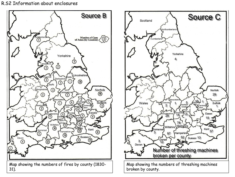
In this example we check if enclosure was the main cause of the Swing Riots. Simply by using a map which shows the extent of enclosure AND two different maps that show where the Swing Riots took place.
The brilliant Neil Thompson introduced this idea to me years ago!
This is great history work. Your pupils will be making inferences from the maps and cross referencing them to test a hypothesis.
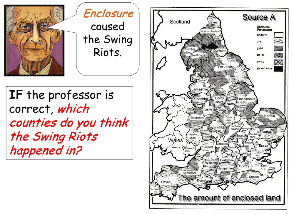
Compare the map above with these two maps to find out if enclosure does appear to be the main reason for the Swing Riots.
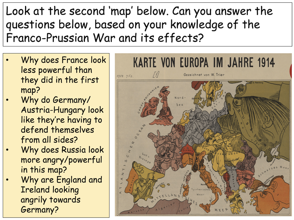
5. Analysing satirical maps as historical evidence
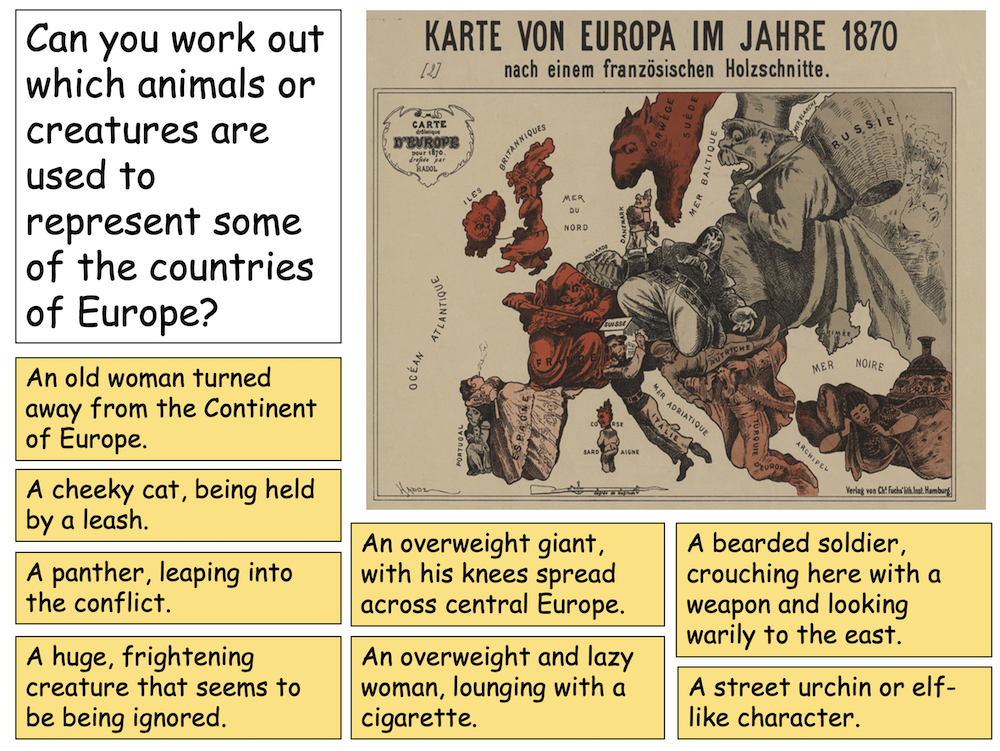
This final idea uses the brilliant satirical map created by Walter Trier in 1914 called ‘Map of Europe in 1870 and in 1914’.
This is a great way to get your pupils to do some decent source work. The focus is to get them to work out what Trier was trying to say about Europe in 1914 simply by analysing his two satirical maps.
I would recommend using these maps near the end of a sequence, explaining the causes of World War One. So, they can use their knowledge to make more sense of the satire.
First we can work out what the 1870 map is saying by matching the descriptions with the country:
Here is the completed version:
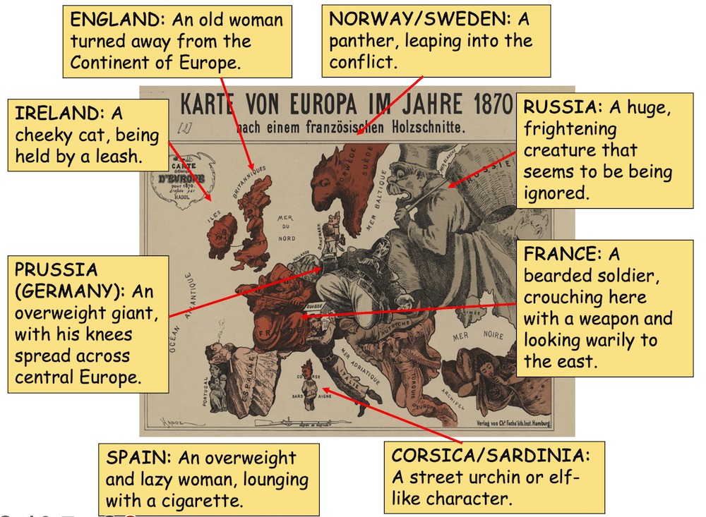
Next you can ask your pupils to work out why each country was portrayed as it was. Can they match the description to the meaning?
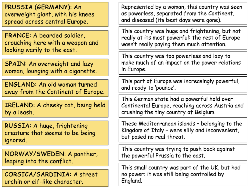
Then compare the situation before 1870 with Trier’s map of 1914. Can they explain why it looks so different? Drawing on their prior knowledge will help them to get to grips with context of the bitterness and rivalry that had built up by 1914. You can find the full lesson here.
So there you have it. 5 ideas to help history teachers think about using maps in the history classroom.
I’m sure that there are plenty more that you already use in your day to day practice.